Buffer Analysis (Area)
Description
This is a specialized script that performs buffer analysis based solely on the buffer area. It builds multi‑ring buffers around source points and calculates the area of each buffer ring intersecting with the specified district boundaries.
Toolbox script Structure
The tool requires the following 6 main input fields: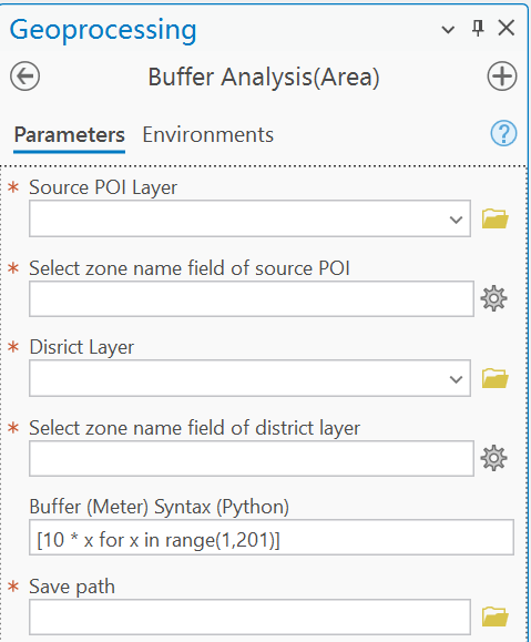
Input Parameters
Source POI Layer
This field specifies the point layer containing the source POIs (centers of the buffers).
Select zone name field of source POI
This field specifies the field that defines zones (e.g., districts) for the source POIs.
Disrict Layer
This field specifies the polygon layer define the boundary of each zone.
Select zone name field of district layer
This field specifies the field that defines zones for the polygon layer.
Ensure that the values in the Select zone name field of source POI and Select zone name field of district layer correspond to the same zones. It is strongly recommended to use the District Divide script to generate the zone name field for the Source POI Layer from the District Layer.
Buffer (Meter) Syntax (Python)
This field defines the buffer radii in meters using a Python list or list comprehension.
Define specific buffer distances (e.g., 10, 20, 50, 100, 500, 1000 meters)
[10, 20, 50, 100, 500, 1000]Generate a range of distances from 10 to 2000 meters with an interval of 10 meters
[10 * x for x in range(1,201)]
Save path
- Enter the base name for the output
CSVfile (do not include the .csv extension).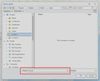
- The results will be saved as
CSVfiles.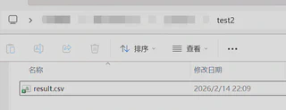
Run the script
After setting all parameters, click Run to execute the script.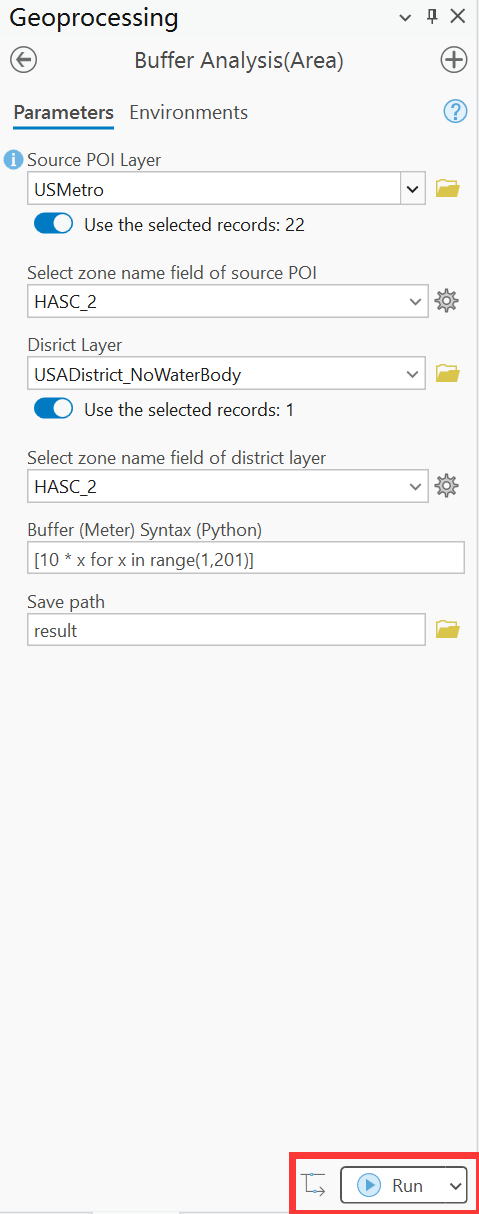
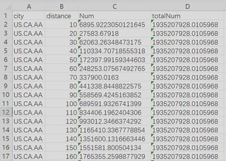
Result structure
The result contains four columns:
- city: The name of the zone, as defined by the Select zone name field of source POI.
- distance: The radius of the buffer (in meters).
- Num: The area of the buffer ring (in square meters) intersecting with the corresponding city boundary for the corresponding city and distance.
- totalNum: The total area (in square meters) of the corresponding city.